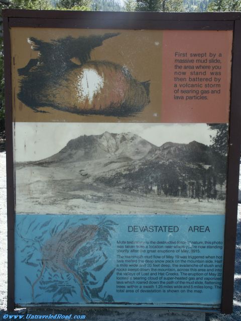
Devastated Area
First swept by a
massive mud slide,
the area where you
now stand was
then battered by
a volcanic storm
of searing gas and
lava particles.
Mute testimony to the destructive force of nature, this photo
was taken from a location near where you're now standing
shortly after the great eruptions of May, 1915.
The mammoth mud flow of May 19 was triggered when hot
lava melted the deep snow pack on the mountain side. Half
a mile wide and 20 feet deep, the avalanche of slush and
rocks swept down the mountain, across this area and into
the valleys of Lost and Hat Creeks. The eruption of May 22
loosed a searing cloud of super-heated gas and vaporized
lava which roared down the path of the mud slide, flattening
trees withing a swath 1.25 miles wide and 5 miles long. The
total area of devastation is shown on the map.